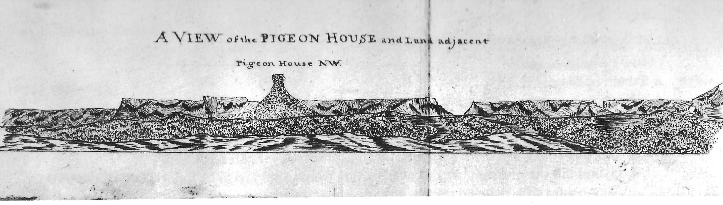
Pigeon House hill
Grade 5: Perhaps the most distinctive and recognised land feature named by Cook on these coasts. Visible from as far away as Mount Dromedary. Well worth the effort to ascend this icon, situated in a wilderness area. Steep 500m climb over more than 3km, ladders at the top. Ensure you are properly prepared.
Situation: Remote, but visible from many places along the coast. Accessed by dirt roads which can be rough and slippery. Approximately 23km west of Ulladulla, on the south coast of New South Wales. Travelling north on Princes Highway, turn left at sign to Pigeon House about 1.5 km north of Termeil (about 35km north of Batemans Bay). From the north, take Wheelbarrow Road south of Burrill Lake.
Aboriginal name: Didthul
Coordinates (decimal): 35.36 S 150.27 E
Endeavour Journal, 22 April 1770:
At Noon we were by observation in the Latitude of 35.27 and Longde 209.23. Cape Dromedary bore S 28 West dist 19 Leags. A remarkable peaked hill lay inland the top of which look’d like a Pigeon house and occasioned my giving it that name, bore N 32 30 W.
Cook refers to the feature in the Log as ‘Pigeon house hill’, but it is now known as Pigeon House Mountain. Joseph Banks writes in his Journal:
The Countrey hilly but rising in gentle slopes and well wooded. A hill was in sight which much resembled those dove houses which are built four square with a small dome at the top… The hill like a pigeon house was also seen at a very great distance; the little dome on the top of it was first thought to be a rock standing up in the sea long before any other part was seen, and when we came up with it we found it to be several miles inland.
Pigeon House proved to be for Cook, and remains today, a prominent Landmark on the coast.