☰ Index
The James Cook Heritage Trail
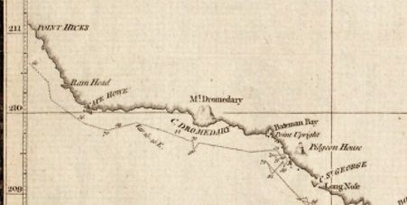
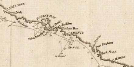
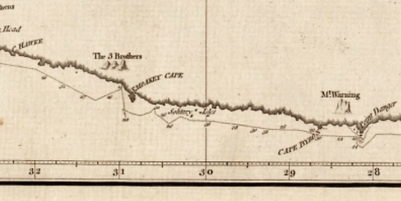
A chart of part of the sea coast of New Holland, by Lt J Cook, Commander of HMB Endeavour 1770 (parts). National Library of Australia obj-231833466
Sections of Cook’s chart, in three parts, from Point Hicks to Point Danger, showing Endeavour’s track and soundings in fathoms. Note that maps of the 1770s did not always accord with the convention of north being to the top of the map!