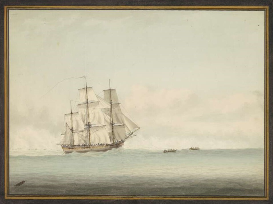
What is the James Cook Heritage Trail?
The James Cook Heritage Trail is a virtual trail along the coasts of Victoria and New South Wales, Australia, taking in the 28 Landmarks (or land features) named by Lt James Cook during his voyage along this coast in HMB Endeavour in April and May 1770. It also includes some important Landmarks that Cook described but did not name. This website provides comprehensive and up to date details of each Landmark (many of which remain just as they were when Cook saw them) and encourages you to visit and enjoy them.
Did you know?
Several of the Landmarks Cook named on the coasts of Victoria and New South Wales are in the wrong place on today’s maps and charts. For the first time in 250 years this website brings together recent research showing their correct locations. In 1970 to commemorate the bicentenary of Cook’s voyage Cape Everard in Victoria was renamed as Point Hicks - it isn’t Cook’s Point Hicks! In a similar 1970 commemorative event at today’s Point Danger, on the border of New South Wales and Queensland, the largest memorial to Cook on the Australian coast was erected – but Cook’s Point Danger is 5km south at Fingal Head!
This website was created to commemorate the 250th anniversary, in 2020, of Cook’s Endeavour voyage by restoring Cook’s legacy on these coasts. It provides a valuable information source as it brings together much recent research on the correct locations of Cook’s named features on the coasts of Victoria and New South Wales. Despite James Cook being one of Australia’s most famous historical figures, it is only recently that, 250 years after the voyage, we have an accurate historical record of what Cook actually saw and named in 1770.

The website is an initiative of Australia on the Map (AOTM) the history and heritage Division of the Australasian Hydrographic Society (AHS) (https://www.australiaonthemap.org.au/,http://www.ahs.asn.au/). Hydrographers are sea surveyors and James Cook is perhaps the most famous hydrographer who ever lived. The James Cook Heritage Trail is a virtual trail along the coasts of Victoria and New South Wales, Australia, taking in the 28 Landmarks (or land features) named by Lt James Cook during his voyage along this coast in HMB Endeavour in April and May 1770. It also includes some important Landmarks that Cook described but did not name. This website provides comprehensive and up to date details of each Landmark (many of which remain just as they were when Cook saw them) and encourages you to visit and enjoy them.
What you will find on this website
- The correct location of each Cook Landmark, details of how to reach it, and information about what you will find there today
- Extracts from Cook’s journal aboard Endeavour recording the naming of each Landmark
- A brief biography of Lt James Cook including an outline of the purpose and achievements of the Endeavour voyage
- Cook’s survey methods and reasons for naming these Landmarks
- Links and references to further information regarding Cook and the Endeavour voyage
Just the beginning…
We want this website to be the focus for a wider interest in Australia’s fascinating multicultural maritime history in a range of ways:
- We hope others might be inspired to take on the task of reviewing the locations of Cook’s named features in Queensland and extending the James Cook Heritage Trail from Point Danger to Possession Island.
- We want to encourage the development of local maritime heritage trails as a tourism attraction. Heritage Tourism is one of the fastest growing segments of the burgeoning home and overseas tourism market. A local maritime heritage trail can be as simple as a leaflet in the local tourism information centre. Maybe one day there will be a comprehensive online maritime heritage trail around the whole Australian coast, including the coastal activities of the indigenous custodians of the land, and all of the European and Asian maritime explorers, plus shipwrecks, lighthouses etc. The AOTM Landings List (see below) provides some ideas and Trevor Lipscombe’s On Austral Shores – a modern traveller’s guide to the European exploration of the Coasts of Victoria and New South Wales, provides one resource for development of local maritime history trails (perhaps shire or historical society based) in those States.
- We invite you to visit the Australia on the Map (AOTM) website: https://www.australiaonthemap.org.au/ There you will find the Landings List (under Categories), the most comprehensive and accurate chronological list of early visits to Australia’s shores, mainly but not exclusively, by Europeans. You will also find, under Newsletters, copies of Map Matters with articles on a variety of aspects of Australia’s early maritime history (these are also online at the National Library of Australia).

As we approach the 250th anniversary of Cook’s exploration and charting of the east coast of New Holland in 1770, the James Cook Heritage Trail website provides a unique and readily available means of reminding us of the circumstances under which places and features that are familiar to us today came to be so named. It also corrects the historical record on a few landmarks that are misnamed on modern maps thus giving us a true record of the east coast of Victoria and NSW as Cook saw it in 1770.
Modern Australia is a direct result of Cook putting the eastern shores of New Holland “on the map”. Australia on the Map, a division of the Australasian Hydrographic Society, through the work of its members, is very proud to offer this significant contribution to the memory of James Cook, his scientific colleagues and the ship's company of HMB Endeavour. I hope it will encourage further research and interest in Cook, in the places described on the website and in our broader maritime history.
Chris Ritchie AO
Vice Admiral RAN (Rtd)
Patron
Australasian Hydrographic Society