Three Brothers
Grade 5: Striking coastal hills and, as Cook notes, a fine navigation aid. Spectacular views from the summits of North and Middle Brother which are both in National Parks and much as they were when Cook sighted them. Not to be missed!
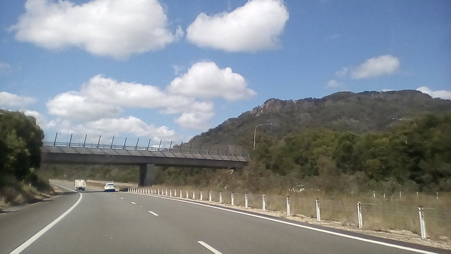
Situation: About 40km south of Port Macquarie the Pacific Highway passes between Middle Brother and North Brother.
Coordinates (decimal):
North Brother: 31.66 S 152.78 E
Middle Brother: 31.70S 152.68 E
South Brother: 31.75S 152.674 E
Aboriginal name: The local Birpai Aboriginal people tell a dreamtime story of three brothers who were killed by a witch called Widjirriejuggi and were buried where the mountains stand. The youngest of the three was Dooragan, after whom the national park which protects North Brother is named.
Endeavour Journal: 12 May 1770
At sun set we were in 23 fathom water and about a League and a half from the land, the nothermost part of which we had in sight bore N 13 East and three remarkable large high hills continguous to each other and not far from the shore bore NNW. As the hills bore some resemblence to each other we call’d them the Three Brothers, they lay in the Latitude of 31.40 S and are of a height sufficient to be seen 14 or 16 Leags.
These hills provide a fine example of Cook’s practice of giving names to prominent, distinctive features which could be viewed from far out to sea. These named features provided a valuable navigation and safety aid for future mariners, as they still do today. While Cook’s latitude for the Three Brothers in the Journal approximates to their position today, on his chart he shows them (as Matthew Flinders noted in 1799) at about 31.25 S.
The impressive coastal hills, North Brother, Middle Brother and South Brother, about 40 kms south of Port Macquarie, are well worth a visit.
Middle Brother is situated in Middle Brother National Park, to the east of the Pacific Highway and south of Kew. There are fine coastal views from Hannam Vale Lookout, near the summit of Middle Brother (554m), and requiring a short walk. Map:
https://www.nationalparks.nsw.gov.au/-/media/visitor/files/pdf/maps/middle-brother-pdf-map.pdf
North Brother (476m) is in Dooragan National Park, near Laurieton. Laurieton Track is a steep, rugged, 3 km one way, track from to the summit from Laurieton. Alternatively you can drive to the summit, a winding 5km climb on the Captain Cook Bicentenary Drive, which was constructed to commemorate the Cook Bicentenary in 1970. At the summit you will find an attractive picnic area and a plaque commemorating Cook’s sighting. Laurieton Lookout provides superb vistas to the north as far as Cook’s Smoky Cape. From the south lookout Watson Taylor Lake is below, and Cook’s Cape Hawke can be seen beyond Crowdy Head. Map:
https://www.nationalparks.nsw.gov.au/-/media/visitor/files/pdf/maps/dooragan-pdf-map.pdf
D A R C 12345 [CC BY-SA 4.0 (https://creativecommons.org/licenses/by-sa/4.0)], from Wikimedia Commons